Category:Wicklow Way
Jump to navigation
Jump to search
walking path  An cuimhneachán J. B. Malone agus Loch Té | |||||
| Upload media | |||||
| Instance of |
| ||||
|---|---|---|---|---|---|
| Location |
| ||||
| Length |
| ||||
| Terminus |
| ||||
| official website | |||||
| |||||
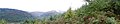
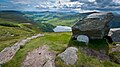
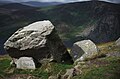
English: The Wicklow Way ( long-distance trail that crosses the Wicklow Mountains in Ireland. It runs from Marlay Park in the southern suburbs of Dublin through County Wicklow and ends in the village of Clonegal in County Carlow. It is designated as a National Waymarked Trail by the Irish Sports Council and is waymarked by posts with a yellow "walking man" symbol and a directional arrow. Typically completed in 5–7 days, it is one of the busiest of Ireland's National Waymarked Trails, with up to 24,000 people a year walking the most popular sections. The Way is also used regularly by a number of mountain running competitions.
Français : Le Wicklow Way (littéralement « chemin de Wicklow » ; randonneurs dans les sections les plus populaires. Il est aussi parcouru régulièrement par des coureurs d'ultra-trail.
Nederlands: De Wicklow Way is een langeafstandswandelpad in Ierland. Hoewel het genoemd is naar het graafschap Wicklow, liggen de uiteinden buiten dit graafschap. Het noordelijke uiteinde ligt in Marlay Park in Rathfarnham in het graafschap Dublin en het zuidelijke uiteinde ligt in Clonegal in het graafschap Carlow. De route leidt langs Glendalough, één van de oudste christelijke kloostervestigingen van Europa.
Media in category "Wicklow Way"
The following 155 files are in this category, out of 155 total.
-
 Ashtown, Co. Wicklow, Ireland - panoramio (1).jpg 2,048 × 1,536; 1.1 MB
-
 Ashtown, Co. Wicklow, Ireland - panoramio.jpg 2,048 × 1,536; 1.19 MB
-
 Ballard, Co. Wicklow, Ireland - panoramio (1).jpg 2,048 × 1,536; 1.17 MB
-
 Ballinafunshoge, Co. Wicklow, Ireland - panoramio (1).jpg 2,048 × 1,536; 1.52 MB
-
 Ballinafunshoge, Co. Wicklow, Ireland - panoramio (2).jpg 2,048 × 1,536; 1.04 MB
-
 Ballinafunshoge, Co. Wicklow, Ireland - panoramio (3).jpg 2,048 × 1,536; 984 KB
-
 Ballinafunshoge, Co. Wicklow, Ireland - panoramio (4).jpg 1,536 × 2,048; 1.07 MB
-
 Ballinafunshoge, Co. Wicklow, Ireland - panoramio (5).jpg 2,048 × 1,530; 875 KB
-
 Ballinafunshoge, Co. Wicklow, Ireland - panoramio (6).jpg 2,048 × 1,536; 1.03 MB
-
 Ballinafunshoge, Co. Wicklow, Ireland - panoramio (7).jpg 2,048 × 1,536; 1.03 MB
-
 Ballinafunshoge, Co. Wicklow, Ireland - panoramio.jpg 2,048 × 1,536; 1.08 MB
-
 Ballinagappoge, Co. Wicklow, Ireland - panoramio (1).jpg 2,048 × 1,536; 1.9 MB
-
 Ballinagappoge, Co. Wicklow, Ireland - panoramio.jpg 1,536 × 2,048; 1.57 MB
-
 Ballinastoe, Co. Wicklow, Ireland - panoramio (1).jpg 2,048 × 1,536; 1.36 MB
-
 Ballinastoe, Co. Wicklow, Ireland - panoramio (2).jpg 1,536 × 2,048; 1.7 MB
-
 Ballinastoe, Co. Wicklow, Ireland - panoramio (3).jpg 2,048 × 1,536; 1.27 MB
-
 Ballinastoe, Co. Wicklow, Ireland - panoramio.jpg 2,048 × 1,536; 1.23 MB
-
 Ballinteer, Dublin, Ireland - panoramio (1).jpg 2,048 × 1,536; 1,013 KB
-
 Ballinteer, Dublin, Ireland - panoramio.jpg 2,048 × 1,536; 1.36 MB
-
 Ballyboy, Co. Wicklow, Ireland - panoramio (1).jpg 1,536 × 2,048; 1.49 MB
-
 Ballyboy, Co. Wicklow, Ireland - panoramio (2).jpg 2,048 × 1,536; 1.67 MB
-
 Ballyboy, Co. Wicklow, Ireland - panoramio (3).jpg 2,048 × 1,536; 1.25 MB
-
 Ballyboy, Co. Wicklow, Ireland - panoramio (4).jpg 2,048 × 1,536; 1.24 MB
-
 Ballyboy, Co. Wicklow, Ireland - panoramio (5).jpg 2,048 × 1,536; 1.27 MB
-
 Ballyboy, Co. Wicklow, Ireland - panoramio (6).jpg 2,048 × 1,536; 1.51 MB
-
 Ballyboy, Co. Wicklow, Ireland - panoramio.jpg 2,048 × 1,536; 1.41 MB
-
 Ballyteige, Co. Wicklow, Ireland - panoramio.jpg 2,048 × 1,536; 1.65 MB
-
 Baltynanima, Co. Wicklow, Ireland - panoramio (1).jpg 2,048 × 1,536; 633 KB
-
 Baltynanima, Co. Wicklow, Ireland - panoramio (2).jpg 2,048 × 1,536; 1.86 MB
-
 Baltynanima, Co. Wicklow, Ireland - panoramio (3).jpg 2,048 × 1,536; 984 KB
-
 Baltynanima, Co. Wicklow, Ireland - panoramio (4).jpg 1,536 × 2,048; 1.42 MB
-
 Baltynanima, Co. Wicklow, Ireland - panoramio.jpg 2,048 × 1,536; 1.24 MB
-
 Boreen bei Tinahely.jpg 3,216 × 4,288; 6.72 MB
-
 Carriglinneen, Co. Wicklow, Ireland - panoramio (1).jpg 1,536 × 2,048; 1.6 MB
-
 Carriglinneen, Co. Wicklow, Ireland - panoramio (2).jpg 1,536 × 2,048; 1.39 MB
-
 Carriglinneen, Co. Wicklow, Ireland - panoramio.jpg 2,048 × 1,536; 1.15 MB
-
 Carrigroe, Co. Wicklow, Ireland - panoramio (1).jpg 2,048 × 1,536; 1.08 MB
-
 Carrigroe, Co. Wicklow, Ireland - panoramio (2).jpg 2,048 × 1,536; 1.06 MB
-
 Carrigroe, Co. Wicklow, Ireland - panoramio.jpg 2,048 × 1,536; 957 KB
-
 Clohernagh, Co. Wicklow, Ireland - panoramio (1).jpg 2,048 × 1,536; 1.26 MB
-
 Clohernagh, Co. Wicklow, Ireland - panoramio.jpg 1,536 × 2,048; 1.75 MB
-
 Crone Wood Car Park - geograph.org.uk - 466470.jpg 640 × 480; 146 KB
-
 Deerpark, Co. Wicklow, Ireland - panoramio (1).jpg 2,048 × 1,536; 1.53 MB
-
 Deerpark, Co. Wicklow, Ireland - panoramio (2).jpg 2,048 × 1,536; 1.1 MB
-
 Deerpark, Co. Wicklow, Ireland - panoramio (3).jpg 1,536 × 2,048; 1.79 MB
-
 Deerpark, Co. Wicklow, Ireland - panoramio.jpg 1,536 × 2,048; 1.47 MB
-
 Derrybawn, Co. Wicklow, Ireland - panoramio (1).jpg 2,048 × 412; 340 KB
-
 Derrybawn, Co. Wicklow, Ireland - panoramio (10).jpg 2,048 × 1,536; 1.72 MB
-
 Derrybawn, Co. Wicklow, Ireland - panoramio (12).jpg 1,536 × 2,048; 1.79 MB
-
 Derrybawn, Co. Wicklow, Ireland - panoramio (13).jpg 2,048 × 1,536; 1.11 MB
-
 Derrybawn, Co. Wicklow, Ireland - panoramio (14).jpg 2,048 × 1,536; 1.02 MB
-
 Derrybawn, Co. Wicklow, Ireland - panoramio (15).jpg 2,048 × 1,536; 800 KB
-
 Derrybawn, Co. Wicklow, Ireland - panoramio (16).jpg 2,048 × 1,536; 1.48 MB
-
 Derrybawn, Co. Wicklow, Ireland - panoramio (17).jpg 2,048 × 1,536; 919 KB
-
 Derrybawn, Co. Wicklow, Ireland - panoramio (18).jpg 1,536 × 2,048; 783 KB
-
 Derrybawn, Co. Wicklow, Ireland - panoramio (2).jpg 2,048 × 1,536; 1.22 MB
-
 Derrybawn, Co. Wicklow, Ireland - panoramio (20).jpg 2,048 × 1,536; 990 KB
-
 Derrybawn, Co. Wicklow, Ireland - panoramio (21).jpg 1,536 × 2,048; 1.03 MB
-
 Derrybawn, Co. Wicklow, Ireland - panoramio (22).jpg 2,048 × 1,536; 1.21 MB
-
 Derrybawn, Co. Wicklow, Ireland - panoramio (23).jpg 1,536 × 2,048; 1.16 MB
-
 Derrybawn, Co. Wicklow, Ireland - panoramio (24).jpg 2,048 × 1,536; 1.08 MB
-
 Derrybawn, Co. Wicklow, Ireland - panoramio (25).jpg 2,048 × 1,536; 1.78 MB
-
 Derrybawn, Co. Wicklow, Ireland - panoramio (26).jpg 2,048 × 1,536; 717 KB
-
 Derrybawn, Co. Wicklow, Ireland - panoramio (27).jpg 2,048 × 1,536; 1.28 MB
-
 Derrybawn, Co. Wicklow, Ireland - panoramio (28).jpg 2,048 × 1,536; 1.01 MB
-
 Derrybawn, Co. Wicklow, Ireland - panoramio (29).jpg 2,048 × 2,048; 1.8 MB
-
 Derrybawn, Co. Wicklow, Ireland - panoramio (3).jpg 1,536 × 2,048; 1.53 MB
-
 Derrybawn, Co. Wicklow, Ireland - panoramio (30).jpg 2,048 × 1,536; 1.6 MB
-
 Derrybawn, Co. Wicklow, Ireland - panoramio (4).jpg 1,536 × 2,048; 1.64 MB
-
 Derrybawn, Co. Wicklow, Ireland - panoramio (5).jpg 1,536 × 2,048; 1.87 MB
-
 Derrybawn, Co. Wicklow, Ireland - panoramio (6).jpg 2,048 × 1,536; 1.31 MB
-
 Derrybawn, Co. Wicklow, Ireland - panoramio (7).jpg 2,048 × 1,536; 883 KB
-
 Derrybawn, Co. Wicklow, Ireland - panoramio (8).jpg 2,048 × 1,536; 1.21 MB
-
 Derrybawn, Co. Wicklow, Ireland - panoramio (9).jpg 2,048 × 1,536; 969 KB
-
 Droning Out The Peace (Unsplash).jpg 3,504 × 2,336; 4.92 MB
-
 Drumgoff, Co. Wicklow, Ireland - panoramio (1).jpg 2,048 × 1,536; 926 KB
-
 Drumgoff, Co. Wicklow, Ireland - panoramio (2).jpg 2,048 × 1,536; 1,004 KB
-
 Drumgoff, Co. Wicklow, Ireland - panoramio (3).jpg 2,048 × 1,536; 931 KB
-
 Drumgoff, Co. Wicklow, Ireland - panoramio.jpg 2,048 × 1,536; 1.61 MB
-
 Dublin, Ireland - panoramio (105).jpg 2,048 × 1,536; 1,013 KB
-
 Dublin, Ireland - panoramio (106).jpg 2,048 × 1,536; 1.35 MB
-
 Enniskerry, Co. Wicklow, Ireland - panoramio (1).jpg 2,048 × 1,536; 1.36 MB
-
 Enniskerry, Co. Wicklow, Ireland - panoramio (2).jpg 1,536 × 2,048; 1.17 MB
-
 Enniskerry, Co. Wicklow, Ireland - panoramio (3).jpg 2,048 × 1,536; 906 KB
-
 Enniskerry, Co. Wicklow, Ireland - panoramio (4).jpg 1,536 × 2,048; 888 KB
-
 Enniskerry, Co. Wicklow, Ireland - panoramio.jpg 2,048 × 1,536; 1.17 MB
-
 Forestry Track - geograph.org.uk - 523787.jpg 640 × 480; 130 KB
-
 Glaskenny, Co. Wicklow, Ireland - panoramio (1).jpg 2,048 × 1,536; 1.42 MB
-
 Glaskenny, Co. Wicklow, Ireland - panoramio.jpg 2,048 × 1,536; 1.33 MB
-
 Inns Quay, Dublin, Ireland - panoramio (4).jpg 2,048 × 1,536; 1,010 KB
-
 Inns Quay, Dublin, Ireland - panoramio (5).jpg 2,048 × 1,536; 1.02 MB
-
 Inns Quay, Dublin, Ireland - panoramio (6).jpg 2,048 × 1,536; 1.29 MB
-
 Inns Quay, Dublin, Ireland - panoramio (7).jpg 2,048 × 1,536; 1.19 MB
-
 Inns Quay, Dublin, Ireland - panoramio (8).jpg 2,048 × 1,536; 890 KB
-
 J B Malone Memorial - geograph.org.uk - 128608.jpg 424 × 640; 67 KB
-
 J B Malone Memorial.jpg 4,288 × 2,412; 4.07 MB
-
 J.B. Malone memorial and boardwalk.jpg 2,738 × 4,015; 6.18 MB
-
 J.B. Malone memorial stone.jpg 4,928 × 3,264; 8.15 MB
-
 Laragh East, Co. Wicklow, Ireland - panoramio (1).jpg 2,048 × 1,536; 1.33 MB
-
 Laragh East, Co. Wicklow, Ireland - panoramio (2).jpg 2,048 × 1,536; 1.18 MB
-
 Laragh East, Co. Wicklow, Ireland - panoramio (3).jpg 2,048 × 1,536; 1.37 MB
-
 Laragh East, Co. Wicklow, Ireland - panoramio (4).jpg 2,048 × 1,536; 2 MB
-
 Laragh East, Co. Wicklow, Ireland - panoramio (5).jpg 2,048 × 1,536; 1,002 KB
-
 Laragh East, Co. Wicklow, Ireland - panoramio (6).jpg 2,048 × 1,536; 1.57 MB
-
 Laragh East, Co. Wicklow, Ireland - panoramio (7).jpg 2,048 × 1,536; 1.16 MB
-
 Laragh East, Co. Wicklow, Ireland - panoramio.jpg 2,048 × 1,536; 1.05 MB
-
 Lough Tay and Luggala.jpg 4,608 × 3,456; 4.75 MB
-
 Lough Tay, Wicklow mountains national park.jpg 3,968 × 2,976; 5.88 MB
-
 Mucklagh, Co. Wicklow, Ireland - panoramio (1).jpg 2,048 × 1,536; 1.51 MB
-
 Mucklagh, Co. Wicklow, Ireland - panoramio (2).jpg 2,048 × 1,536; 1,024 KB
-
 Mucklagh, Co. Wicklow, Ireland - panoramio (3).jpg 2,048 × 1,536; 1.03 MB
-
 Mucklagh, Co. Wicklow, Ireland - panoramio (4).jpg 2,048 × 1,536; 956 KB
-
 Mucklagh, Co. Wicklow, Ireland - panoramio (5).jpg 2,048 × 1,536; 2.16 MB
-
 Mucklagh, Co. Wicklow, Ireland - panoramio (6).jpg 2,048 × 1,536; 985 KB
-
 Mucklagh, Co. Wicklow, Ireland - panoramio (7).jpg 1,536 × 2,048; 1.47 MB
-
 Mucklagh, Co. Wicklow, Ireland - panoramio (8).jpg 2,048 × 1,536; 1.21 MB
-
 Mucklagh, Co. Wicklow, Ireland - panoramio.jpg 1,536 × 2,048; 1.51 MB
-
 Phoenix Park, Dublin, Ireland - panoramio.jpg 2,048 × 1,536; 571 KB
-
 Powerscourt Paddock, Co. Wicklow, Ireland - panoramio (1).jpg 2,048 × 1,536; 909 KB
-
 Powerscourt Paddock, Co. Wicklow, Ireland - panoramio (2).jpg 2,048 × 2,048; 1.7 MB
-
 Powerscourt Paddock, Co. Wicklow, Ireland - panoramio (3).jpg 2,048 × 1,536; 789 KB
-
 Powerscourt Paddock, Co. Wicklow, Ireland - panoramio (4).jpg 1,536 × 2,048; 1.38 MB
-
 Powerscourt Paddock, Co. Wicklow, Ireland - panoramio (5).jpg 2,048 × 1,536; 783 KB
-
 Powerscourt Paddock, Co. Wicklow, Ireland - panoramio (6).jpg 2,048 × 2,048; 1.15 MB
-
 Powerscourt Paddock, Co. Wicklow, Ireland - panoramio (7).jpg 2,048 × 1,536; 1,013 KB
-
 Powerscourt Paddock, Co. Wicklow, Ireland - panoramio (8).jpg 2,048 × 2,048; 1.67 MB
-
 Powerscourt Paddock, Co. Wicklow, Ireland - panoramio.jpg 2,048 × 1,536; 894 KB
-
 Raheen, Co. Wicklow, Ireland - panoramio.jpg 2,048 × 1,536; 1.58 MB
-

-
 Sleamaine, Co. Wicklow, Ireland - panoramio (1).jpg 2,048 × 1,530; 1.3 MB
-
 Sleamaine, Co. Wicklow, Ireland - panoramio (2).jpg 2,048 × 1,536; 1.23 MB
-
 Sleamaine, Co. Wicklow, Ireland - panoramio (3).jpg 2,048 × 1,530; 1.14 MB
-
 Sleamaine, Co. Wicklow, Ireland - panoramio.jpg 2,048 × 1,536; 1.15 MB
-
 Snow on White Hill - geograph.org.uk - 128628.jpg 640 × 425; 51 KB
-
 Sraghmore, Co. Wicklow, Ireland - panoramio.jpg 2,048 × 1,536; 996 KB
-
 Steps - geograph.org.uk - 523790.jpg 640 × 480; 139 KB
-
 The Wicklow Way - geograph.org.uk - 1928759.jpg 4,000 × 3,000; 4.52 MB
-
 The Wicklow way from Djouce Mountain - geograph.org.uk - 919588.jpg 640 × 480; 65 KB
-
 Turning a corner on the Wicklow Way - geograph.org.uk - 541137.jpg 640 × 480; 135 KB
-
 View of Djouce Mountain - geograph.org.uk - 523799.jpg 640 × 480; 68 KB
-
 Wicklow Way - geograph.org.uk - 523804.jpg 640 × 480; 88 KB
-
 Wicklow Way banner Lough Tay.jpg 3,968 × 568; 1.36 MB
-
 Wicklow Way Clonegal Trailhead.jpg 2,185 × 1,943; 2.72 MB
-
 Wicklow Way Conifer Plantation.jpg 3,958 × 2,226; 3.87 MB
-
 Wicklow Way Glendalough.jpg 4,288 × 2,412; 5.03 MB
-
 Wicklow Way Halfway Point.jpg 4,288 × 2,412; 2.02 MB
-
 Wicklow Way Lugnaquilla.jpg 4,288 × 2,412; 4.78 MB
-
 Wicklow Way Marker Curtlestown.jpg 3,644 × 2,050; 3.1 MB
-
 Wicklow Way Marlay Park Trailhead.jpg 3,142 × 2,793; 4.41 MB
-
 Wicklow Way near Moyne.jpg 4,200 × 2,363; 4.39 MB
-
 Wicklow way near Mullacor.png 3,611 × 2,259; 15.08 MB
-
 Wicklow Way Waymarker.jpg 3,699 × 2,081; 1.57 MB
-
 Wicklow Way.jpg 3,888 × 2,592; 13.1 MB
-
 WicklowWay.JPG 4,000 × 3,000; 2.23 MB
-
 WicklowWaySign.JPG 3,000 × 4,000; 2.94 MB
.jpg)

.jpg)
.jpg)
.jpg)
.jpg)
.jpg)
.jpg)
.jpg)
.jpg)

.jpg)

.jpg)
.jpg)
.jpg)

.jpg)

.jpg)
.jpg)
.jpg)
.jpg)
.jpg)
.jpg)


.jpg)
.jpg)
.jpg)
.jpg)


.jpg)
.jpg)

.jpg)
.jpg)

.jpg)


.jpg)
.jpg)
.jpg)

.jpg)
.jpg)
.jpg)
.jpg)
.jpg)
.jpg)
.jpg)
.jpg)
.jpg)
.jpg)
.jpg)
.jpg)
.jpg)
.jpg)
.jpg)
.jpg)
.jpg)
.jpg)
.jpg)
.jpg)
.jpg)
.jpg)
.jpg)
.jpg)
.jpg)
.jpg)
.jpg)
.jpg)
.jpg)
.jpg)
.jpg)

.jpg)
.jpg)
.jpg)
.jpg)
.jpg)
.jpg)


.jpg)

.jpg)
.jpg)
.jpg)
.jpg)
.jpg)


.jpg)
.jpg)
.jpg)
.jpg)
.jpg)
.jpg)
.jpg)


.jpg)
.jpg)
.jpg)
.jpg)
.jpg)
.jpg)
.jpg)
.jpg)


.jpg)
.jpg)
.jpg)
.jpg)
.jpg)
.jpg)
.jpg)
.jpg)


.jpg)
.jpg)
.jpg)


.jpg)